Ian shifts east
Friday, September 30, 2022
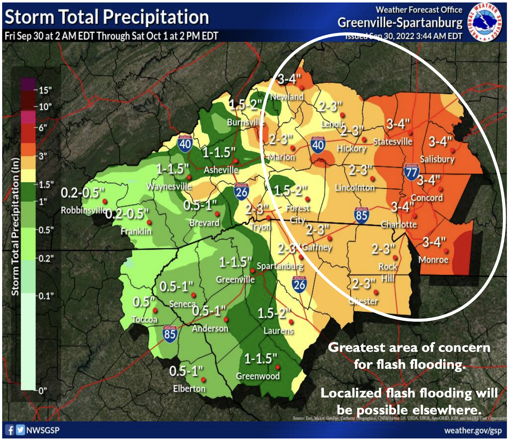
The forecast continues to improve for areas west of 1-26, with fewer impacts from Ian expected. However, we are not in the clear yet.
Ian is expected to make its second landfall between Charleston and Myrtle Beach as a Category 1 Hurricane this afternoon.
Confidence is high on Ian turning north, then northwest into the Carolinas today into Saturday before dissipating.
Ian continues to bring the potential for flash flooding and possibly some main-stem river flooding (note: rainfall totals continue to decrease).
Strong winds are expected across the area and mountain ridgetops.
Expect widespread rainfall to move in from east-to-west throughout the day.