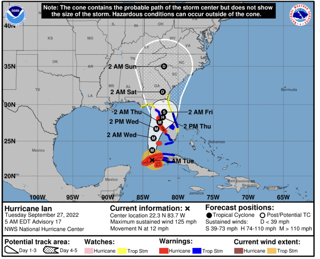
Ian now a Cat 3, reaches Cuba
Tuesday, September 27, 2022
From NWS:
Hurricane Ian is expected to remain a major hurricane as it enters the Gulf of Mexico. Ian is currently most likely to make landfall along the western FL peninsula early Thursday. Ian is expected to weaken to a depression by the time it gets close to the western Carolinas and northeast Georgia.
Based on the latest forecast track, possible impacts could be felt across the western Carolinas and northeast Georgia as early as Friday morning. The main impacts may be Friday night through Saturday.
HAZARDS & IMPACTS
▪ Heavy rain and gusty winds are expected as the storm moves north into southern GA.
▪ Some areas may experience flooding, especially near the eastern Blue Ridge Escarpment.
▪ Even though winds are expected to be lower than tropical storm force, saturated soils and gusty winds may lead to some trees down and possible power outages.
FORECAST CHALLENGES
▪ Confidence is increasing on the storm track and expected impacts, but is still low on the timing, due to the storm’s expected slow movement.
