Severe Weather

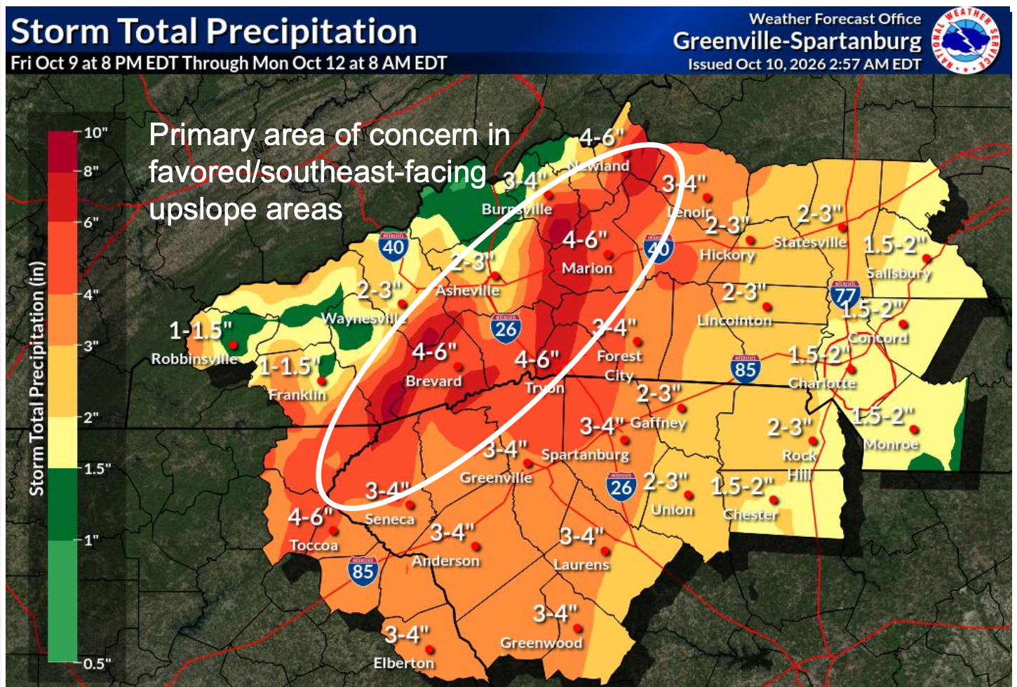
A large portion of the region will receive 2-4”, although higher amounts, in excess of 8”, is expected on the southeast-facing slopes of the Appalachians

Isaias Update 10/10

Important Updates ➔ The Flood Watch has been expanded across the Upstate. ➔ Isaias is now a Post-Tropical Cyclone as it weakens. ➔ Despite the weakened system, heavy rainfall and strong winds are still expected, along with a low-end tornado threat. Key Messages ● The...
read more
Rainfall totals map from the National Weather Service showing rainfall totals ranging from 1.5 inches in the northern end of the county to 3-4 inches in the southern end of the county.

Isaias Update 10/9

The rainfall totals and wind conditions have risen some since the last update. The southern end of Haywood County (Cruso and Lake Logan) will see the heaviest rain. Rainfall totals will taper off toward the northern end of the county. We can expect nuisance flooding,...

read more
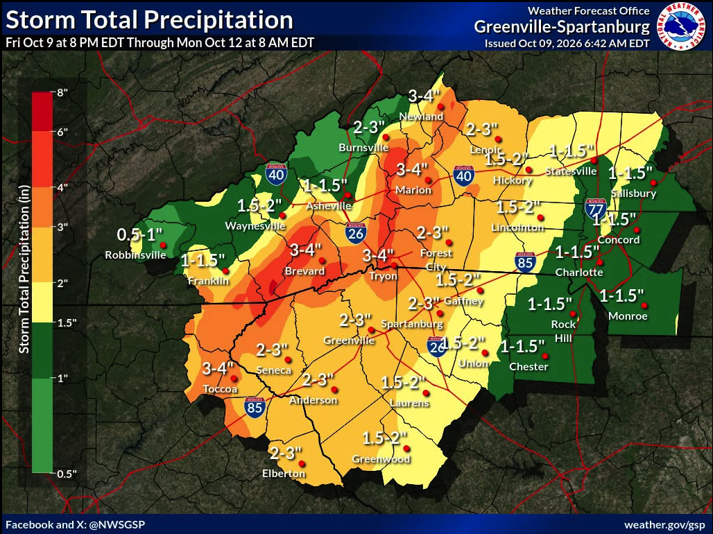
Map showing rainfall predictions from Isaias with 3-4 inch totals near Tryon (highest) and localized flash flood risk areas marked. Haywood County is anticipated to receive 1-2 inches.

Isaias Update 10/8/26

Looking carefully at the rainfall totals map graphic, you’ll notice that MOST of Haywood County is in the green 1-1.5 inch rainfall total range.

The southern portion of the county where the Pisgah National Forest is located is in a slightly higher range, 2-3 inches. Heavier rain falling in the southern portion of the county could drain into the Pigeon River.

We may see higher river levels, but severe flooding is NOT expected from this storm as of this forecast.

We’re keeping a close eye on this system as it develops.

read more

Helene Situation Report #1

Emergency Shelter Opening Thursday, September 26, 2024 Haywood Hurricane Helene Preparations and Situation Update 1 Haywood County could experience historic flooding. Flash Flooding: Widespread flash flooding is expected, with some areas at risk for catastrophic and...

read more

Haywood County Prepares for Helene

Heavy wind, rain, then snow Wednesday, September 25, 2024 As the projected impacts of Hurricane Helene become more certain, Haywood County is mobilizing all available resources to protect its residents, visitors, and resources. All available emergency personnel and...

read more

Winter Weather Advisory

Extreme cold, snow Sunday, January 14, 2024Extreme cold moves into the region tonight. A Winter Weather Advisory is issued for Haywood County from 1 a.m. Monday through 7 a.m. Tuesday. Bitter wind chill values may range from zero to 10 degrees below zero, with high...

read more

June 2023 Rain Event

Rain, Rain, More Rain Tuesday, June 20, 2023 Excess rain is all around us this week, and complicating things is a series of tropical systems developing in the Atlantic. Of biggest concern: 1. Excess rain could cause flooding in some areas. The threat will depend on...

read more

Winter Weather January 12-13, 2023

Heavy wind, rain, then snow Thursday, January 12, 202A cold front will cross the area today bringing the threat of severe thunderstorms with damaging wind gusts and a few brief tornadoes.  Cold air and lingering moisture behind the front will cause the rain to change...

read more

Tropical Depression Nicole Update

Nicole Update - Friday Noon Nicole is now a tropical depression and the forecast impacts for NC remain largely unchanged. The system is expected to accelerate to the N and NE today, moving over NC later today. Nicole is forecast to become post-tropical later today and...

read more

Tropical Storm Nicole Update

Nicole Update — Thurs. AM Nicole will track northwest across Florida today before lifting northeast towards Georgia and the Carolinas late tonight into Friday. Nicole’s track has shifted slightly farther west. Continued small adjustments to the track could change the...

read more
Select Language - Seleccione el idioma »