Keeping an eye on Ian
Monday, September 26, 2022
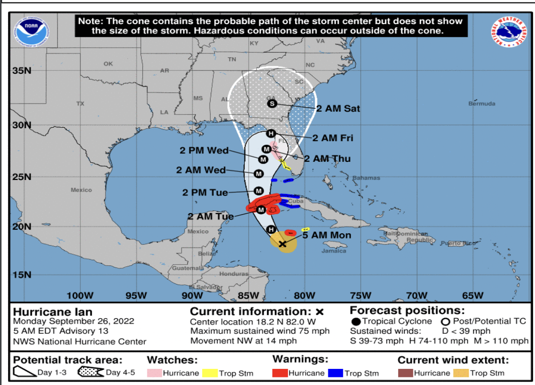
We’re keeping an eye on Ian —
• Overnight, Ian strengthened into a hurricane and is expected to rapidly intensify into a major hurricane.
• Prior to Ian, most areas will remain dry through Thursday afternoon, but isolated showers/storms will be possible. In WNC impacts could be seen through the weekend.
• The greatest threat to NC will likely be heavy rain, gusty winds, flooding, and isolated tornadoes. Heavy rain could result in areas of flash flooding and the potential for river flooding.
• Timing, location, and magnitude of impacts will gain clarity over the next few days as the forecast becomes more refined.