
Isaias Update 10/10

Oct 10, 2026 | Severe Weather, Updates

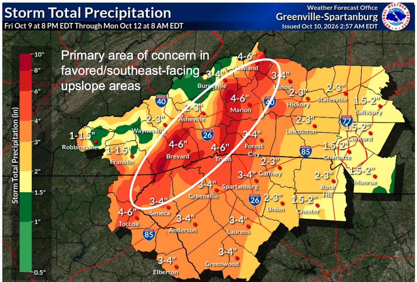
A large portion of the region will receive 2-4”, although higher amounts, in excess of 8”, is expected on the southeast-facing slopes of the Appalachians

Looking carefully at the rainfall totals map graphic, you'll notice that MOST of Haywood County is in the green 1-1.5 inch rainfall total range.

The southern portion of the county where the Pisgah National Forest is located is in a slightly higher range, 2-3 inches. Heavier rain falling in the southern portion of the county could drain into the Pigeon River.

We may see higher river levels, but severe flooding is NOT expected from this storm as of this forecast.

We're keeping a close eye on this system as it develops.

Important Updates

➔ The Flood Watch has been expanded across the Upstate.

➔ Isaias is now a Post-Tropical Cyclone as it weakens.

➔ Despite the weakened system, heavy rainfall and strong winds are still expected, along with a low-end tornado threat.

Key Messages

● The remnants of Isaias are expected to move across Alabama today and into the Tennessee Valley tonight.

● A flash flood threat will develop across the area today and continue through Sunday morning.

● Very gusty winds and a low-end tornado threat will accompany the remnants today into Sunday

Select Language - Seleccione el idioma »
Shares
Share This