
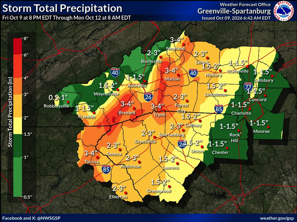
The rainfall totals and wind conditions have risen some since the last update. The southern end of Haywood County (Cruso and Lake Logan) will see the heaviest rain. Rainfall totals will taper off toward the northern end of the county. We can expect nuisance flooding, meaning some low-lying streets may flood and some smaller branches may have minor flooding. We do not expect major or widespread flooding with this storm.
Steps to prepare:
1. Sign up for Haywood Alerts
2. Make sure Emergency Alerts are enabled on cell phones
3. Set up and tune your weather radio to 162.400
4. Have emergency kits handy
5. Remember: If sirens sound... Hi-Lo, it's Time to GO!
From National Weather Service - Greenville / Spartanburg
 WEATHER UPDATE: Hurricane Isaias (11 AM EDT Advisory)
Here is the latest update on Hurricane Isaias and the timing of local impacts across our region this weekend:
 HEAVY RAIN & FLOODING: Heavy rainfall brings a risk of localized flash flooding, especially along the Blue Ridge Escarpment, with 3-5+ inches possible.
 Timing: Saturday through the first half of Sunday
 GUSTY WINDS: Widespread wind gusts of 30–40 mph across the area, with higher gusts of 50–60 mph above 3,500 ft in the NC mountains.
Timing: Saturday morning into Saturday night
 TORNADO RISK: A low-end tornado threat exists for the Piedmont regions of the western Carolinas and northeast Georgia.
Timing: Saturday through Sunday morning
 Action Steps: Secure loose outdoor items, make sure your severe weather alerts are enabled, and never drive through flooded roads!
Track the forecast updates at weather.gov/gsp.